Tuesday, November 23, 2010

Grand Cayman, Cayman Islands


A very small island within the Cayman Islands (all three islands that make up the system really are only 100 square miles put together) located in the Caribbean.

The first thing I noticed when researching this island, is that locating a topographic map of it is basically impossible. But I quickly figured out by looking at this satellite image, that the problem may occur due to the fact that the island is virtually flat.

In terms of hazards, large hurricane storms are always a threat. For instance, in this news article, though it does not discuss directly a storm the Cayman Islands have been through, it mentions storms they have been through in the past and how this makes many people on the islands empathetic when similar tropical storms occur elsewhere in the Caribbean.

One especially notable type of vegetation on the island is the mangrove forest, a beautiful host to rich biodiversity.


Finally, here's a link to a peer reviewed article abstract, discussing both natural and man-made hazards on the island. The main hazards it identifies are those which involve storms, such as hurricanes as was discussed earlier and is pretty typical for the region.

Monday, November 22, 2010

Gimmelwald, Switzerland

Peer review article here

Gimmelwald, Switzerland


Gimmelwald is a beautiful little mountain town nestled 4,500 feet above sea level in the Bernese Oberland part of the Swiss Alps. The views from Gimmelwald are breath taking. This tiny town can only be reached by hiking or by gondola. Gimmelwald's population (or lack thereof) is 130 people, and not one of them owns a car. Farming is the primary occupation, and Gimmelwald is well known for its delicious cheese.


Vegetation:
The vegetation is alpine and sub-alpine, with lots of wildflowers blooming in the summer months.

Climate:
Because Gimmelwald is such a small town, there is no direct climate graph for it. However, Gimmelwald is very close to Bern, Switzerland and shares the same climate characteristics. Here is the
climate table for Bern. As you can see, Gimmelwald is very cold in the winter months, getting plenty of snow that allow its nearby ski resorts to stay open from November until April. The summers are mild and the area has low humidity year-round.
Natural Disaster:
There are no real natural disasters that occur in Gimmelwald. Members of the community got the area to be falsely declared as an avalanche zone, but this was to stop the urbanization of the town, not because it actually is one. Other than the very small chance of avalanche, there are no real natural disasters in Gimmelwald.
Here is a topographic map of the area.


The article "Fluctuations of Climate and Glaciers in Bernese Oberland, Switzerland, and their Geoecological Significance," by Bruno and Paul Messerli discusses how scientists can look at the change of area and volume of ice in the Bernese Oberland and draw conclusions about the area's climate change over a long period of time.

Madagascar

Political Map of Madagascar


Topographic Map of Madagascar


More detailed Topographic Map


Madagascar is the world's fourth largest island, located off of the southeastern coast of Africa, with a population of nearly 20 million.

Natural Hazards: Madagascar is not as much of a victim of natural hazards as it is from hazards such as epidemics, or disease, which are much more common, however take much less of a toll. However, here you will see that droughts and storms account for mostly all of the natural disasters on Madagascar. Tropical storms are the most frequent visitors, because Madagascar is in the direct storm path of the Indian Ocean basin. A common tropical storm in Madagascar can be seen here. In March, 36 lives were taken and 38,000 were left homeless during Tropical Storm Hubert. Rain can also be sparse in Madagascar, which is why drought is always a major threat.

Vegetation: Sub-humid forests are extremely common on the island, and are evident on the plateau in the center of the island nation. Because of the great plains in the west, cattle grazing is optimal. On the east side of the island, a forest canopy to nearly 30 meters can be found. On the drier, west side, shrubs and grasslands are much more common.


Climate: The rainy season is from November to April, with dry and cool temperatures from May to the end of October. The east side of the island is exposed to rainfall the most, with 3.5 meters falling annually. In addition, the Indian Ocean anticyclone plays a major role in the climate of Madagascar due to the winds, which orginiate out of the Indian Ocean. Because the winds and most of the bad weather arrive from the east, the west side of the island receives much less rainfall.


Peer Reviewed Journal:
http://www.jstor.org/stable/30039782?seq=1

This discusses global climate change, and how the natural environment of Madagascar has declined. Human settlement on Madagascar has diminished most all of the forests that were once there, and now with all of the climate change, droughts, wildfires, and other natural disasters have the possibility to become more common.

The Outback


The Outback is a vast, remote and arid area of Australia. Covering most of Australia, the Outback is home to a diverse set of species, such as the Kangaroo, Emu and Dingo.


Location
  • The Outback of Australia encompasses portions of five out of six territories, excluding the island territory of Tasmania. Defined without official borders, the Outback encompasses the interior of the South-of-the-Equator continent.

    The Outback includes the Southern region of the Northern Territory, the Central and Eastern portions of Western Australia, the Northern and Central portions of Southern Australia, the Northwest corner of New South Wales, the Southeastern portion of Queensland and the far Northwestern areas of Victoria.
  • Rain

  • Seventy percent of inland Australia maintains an arid climate. The Outback area sees very little rain and can go years without any precipitation. The central region receives the least rainfall of the entire country. The driest location in the Outback is Mulka Station on the Birdsville Track. On average they receive 120mm, or just under 5 inches, of rain per year.
  • Wind

  • Seasons dictate wind patterns in Australia. From October through March expect winds to blow from the Southeast. The strongest winds gust from October to December. The Aboriginal people of Australia refer to the last few months of the year as "the windy season." The combination of wind and areas with little vegetation makes dust storms common in the Outback. Winds fade to a gentle breeze during the cooler months of April through September.
  • Temperature

  • Since the Outback covers large portions of the continent, maximum temperatures range from 18 to 39 degrees Celsius, or roughly 64 to 102 degrees Fahrenheit. The coolest month to visit is July, the height of the winter season. Temperatures can drop below freezing. During the summer, the sand hills and rock structures get much warmer than the plains and desert areas. Temperatures can climb to 50 degrees Celsius, or 122 degrees Fahrenheit.
  • Facts

  • The interior of Australia harbors no major cities due to the climate. The land can't support farming. The sparse vegetation in the region has adapted to receiving very little precipitation, according to the Australian Government Bureau of Meteorology. Eighty percent of Australia receives less than 600mm, or 23.6 inches of rainfall per year.

  • Peer Reviewed article here
    Title: "No Mallee Bull, the Outback is Out There"


    Fernando de Noronha

    Fernando de Noronha is an archipelago of 21 islands, the main island is the focus of my project. the main island, also called Fernando do Noronha is the only inhabited island and it is 350 km from the coast of Brazil.

    Some notable features on the maps of Fernando de Noronha are the one small airport runway in the middle of the island, "Dolphin Bay" where the worlds largest Spinner Dolphin colony inhabits, Morro do Pico "Peaks Hill" a huge rock that can be seen anyhere on the island, the main town nearer to the top of the island, Fortaleza de Nossa Senhora dos Remedios, "The Fort of our Lady of Remedios Fernando de Noronha" an abondoned fort used to shelter world war 2 soldiers.


    Fernando de Noronha is free of hurricanes and no big tsunamis or earthquakes. Fernando de Noronha does get severe tropical storms with high winds, heavy rain, and thunder. An example of the consequences of these severe storms is what happened to a flight from France that hit a severe storm and crashed into the ocean not to far from the island.
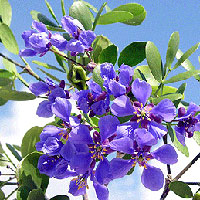


    The natural vegetation of the island is mostly vines and bushes and grasses with a few different species of trees particularly Nyctaginaceae, Bignoniaceae, Anacardiaceae, and Rubiaceae. There are a lot of bushes and shrubs that are not native to the island. The two bushes that are most noted on the island are Capparis Cynophallophora and Burra Leiteira Sapium Scleratum which are bushes that cause a sap that is known to cause burns on humans and animals. A few of the herbs include the harmful climbing vines are Jiteranas, Ipomea, and Merremia. there are also fruit trees that have been introduced to the island including papaya, cashew, and bananna.

    Fernando de Noronha has very consistant tempertures and precipitation levels. Temperatures in Fernando de Noronha remain constant year-roundwith an average of 26 degrees celcius and 80% humidity. The island has two well-defined tropical seasons, the rainy season,January to August, and the dry season, September to December. The months with the most rain are March and April where rains can reach 20cm per day.

    One interesting peer-reviewed article I found was one entitled Interdisciplinary Paleovegetation study in the Fernando de Noronha Island (Pernambuco State), Northeastern Brazil.
    The article discusses determine vegetation changes on the island since the begining of the geologic time, called the holocene. What interested me most about the article was the conclusions which stated that the climate changes that occured did not affect the vegetation. the article discussed many of the important trees, herbs, and bushes disccused in the vegetation section of this post.

    Some fun facts about the island is that the island is home to the worlds largest spinner dolphin population.

    Vacationing on the island is exensive. There is a draconian tax system which is meant to discourage people from staying to long on the island. Guests are taxed everyday they are on the island, us11$ a day for the first 20 days, after that it rises to 372$ a day, and after 30 days it rising again to 910$ a day.

    Also upon arrival local authorites hand out litter bags and register every visitor into a computer base so authorities will no how many visitors are on the island at one time, where they are from, and where they are staying. This is to preserve the environment on the island. Another example of the intense care dedicated to the island is Atalaia beach, which is a beach great for snorkeling. The number of visitors allowed on the beach at a time is restricted to six groups of 18 visitors all who are prohibited from touches the sea floor, they are forced to remain in a floating position at all times.

    The island has 17 beaches, one airport, one highway, and 2800 Brazilians who are lucky enough to live in paradise!

    Saturday, November 20, 2010

    Athens Greece


    Athens, Greece
    is located in the southern part of Europe and juts out into the Mediterranean Sea between the southern end of Italy and the western end of Turkey. The city has a unique landscape of hills and mountains which fall to the Mediterranean Sea. Some of the most famous landmarks of Athens are the ancient Acropolis and the Parthenon. Athens is the capital of Greece. B
    etween 1981 when Greece joined the European Union, and 2004 when Athens hosted the summer Olympic games, Athens grew to become a modern cosmopolitan metropolis, a center of economic, financial, industrial, political and cultural life.

    Athens, Greece has a Mediterranean climate. The summers are hot and dry, with clear, cloudless skies. The average annual temperature in Athens is about 63° F. The extremes range from a normal low of 31° F in January to a normal high off 99° F in July and at times even higher in August. The average rainfall of 1.25 inches. In June through September Athens only gets less than 1/2 inch of rain.

    Athens has a Mediterranean climate and

    its vegetation reflects a sclerophyll biom

    e adapted to survival through regular long summer droughts. The shrubs and trees in such a biome have low branches, thick bark and leaves that resist water loss through transpiration. Outside the city the landscape may appear brown and dry much of the year, however the fertile soil provides for a rich diversity of wildflower from anemones and heliotropes to cacti and olive trees. Of course, Athens is a city with a metropolitan population of around 3.7 million. Much of the city is covered with concrete and many of the older areas either have no natural vegetation or may have vegetation that is cultivated and may not be natural. Athenians love flowers however, and everywhere in the summer the visitor will see bougainvillea, oleander and a myri

    ad of other exotic colorful flowers. In recent years the city has been making an effort to add green space.

    On August 24,2009 a massive

    forest fire

    began bu

    rning just outside the northern border of Athens. According to the European Commission's European Forest Fire Information System 51,890 acres of pine forest, olive grove, brush and farmland, were destroyed. Greek officials say 150 homes were also damaged. Officials have not said what started the fires. Each year alone hundreds of forest fires blaze over Greece.

    The meltemi is an annual midsummer wind that blows across the Aegean Sea southwest out of Turkey. Usually they blow strongest in the afternoon and die down at night but they can blow for days without a break. Since the winds blow from north to south they can make sailing problematic as it's easy to sail in southerly directions but beating back north against often 30-50 knot winds and strong seas is at best tedious and can be dangerous. Athenians and people who live in the Aegean islands welcome the dry cool breeze but north-facing beaches can be unpleasant if sand is blowing in the strong winds. Two summers ago I was sailing in the northern Cyclades and had personal experience with the meltemi.


    Friday, November 19, 2010

    Hokkaido shrew (Sorex caecutiens)

    article abstract

    This article discussed the origination Sorex Caecutien species in Hokkaido. It is believed that through mutation, evolution and isolation, the ancestral population was separated, some going to the eurasian continent, and others going to Hokkaido, and later both species immigrated into the Russian Island Sakhalin (north of Hokkaido) where hybridization occurred.

    Hokkaido climate

    Hokkaido's climate is characterized by cool summers and icy winters. Precipitation is highest in late summer and early fall (August, September), with January as its coldest month and August as the warmest.

    Hokkaido natural vegetation


    The natural vegetation of Hokkaido consists of montane conifers such as fir and spruce at higher elevations, and norther hardwoods such as oak, maple, and elm at lower altitudes. Because Hokkaido produces much of Japans wheat, potatoes, corn, rice, and dairy products, most of the flat land is used as pastures for animals such as cows, or as fields for agriculture. Species present in Hokkaido include red crested white cranes, white foxes, brown bears, and flying squirrels.


    Hokkaido natural hazard


    September 25, 2003 Earthquake
    On september 25, 2003, Hokkaido experienced a 8.3 magnitude earthquake. Earthquakes as well as volcanoes are very common in Japan because of its location on the fault line of the pacific ring of fire

    Hokkaido maps

    Hokkaido is Japan's northernmost and second largest island. It has a mountainous terrain and is home to 18 active volcanoes. Coastal Planes also cover much of the land.


    Wednesday, November 17, 2010

    EspaƱa


    Natural Disasters:
    Earthquakes are common natural disasters in Spain. One of the more recent ones took place on April, 2010. The epicenter of the quake was located near Granada, Spain and the earthquake was recorded as a 6.2 magnitude
    Spain has also been prone to wildfires. They commonly occur in the Andalusia forests. One of the main factors of forest fires in Spain are the Eucalyptus tree.

    Vegetation:

    Spain's vegetation is most abundant in the spring and summer seasons.
    The macquis shrub is plentiful in areas lacking agriclture or forest. They include plants such as lavender, thyme and rosemary. The forests of the mountains in Spain include conifer or evergreen, of the evergreens, the scotch pine is common. The cork oak is a common evergreen oak located in Spain. The lower elevations of the mountains include many deciduous tree species. 


    The DoƱana National Park is one of Spain's most popular national parks. The park is located in Southwestern Spain in AndalusiaSpain's largest and most popular region. The park consists of marshes, sand dunes, and shallow streams. The national park rock make-up consists of clay, limestone, and sand. Also called Coto de DoƱana, it is home to the Spanish Lynx, rabbit species, and many species of birds such as the Purple Heron. Some plant species that can be found in the park are oleander, wallflower of the sea, heather, and lavender.
    The DoƱana National Park

    Quercus Pyrenaica is a deciduous species found along the Mediterranean on the Iberian Peninsula, where Spain is located. A common animal found in the area of the Mediterranean and Iberian Peninsula is the Iberian Lynx. Spain is a Chaparral, or Mediterranean forest, therefore it is apart of the temperate biome.

    Climate:
    The climate of Spain is split in to two parts. Separate by the Cantabrian Mountains, rainy Spain is located to the north and dry Spain to the south. Rainy Spain is more of a temperate climate with cooler summers and mild winters. Dry Spain consists of hot summers and cold winters. Mediterranean Spain has humid winters and dry summers. The weather in Spain varies depending on the time of the year. It is warmest in the summer season and coolest in the winter season. Most of the rainy season takes place in the winter.

    Tuesday, November 16, 2010

    Kamchatka


    The Kamchatka Peninsula, located in the Russian Far East, is a place of scenic beauty and biological diversity. Kamchatka, most notably known for its impressive volcanoes and thriving brown bear populations, is one of the few last true frontiers. First visited by outsiders in 1697, the wilderness of Kamchatka still remains largely unseen by humans. Kamchatka is famous for its impressive and unique geographic features. Rugged and mountainous, active volcanoes (Avachinsky, Krasheninnikov, Kronotsky, and Uzon) poke the sky, dominating the landscape. Few people call Kamchatka home due to its remote location, delicate ecosystem, and harsh climate. Therefore, Kamchakta remains largely undeveloped. In addition to its impressive chain of volcanoes, Kamchatka is home to the only geyser field in mainland Eurasia,The Valley of Geysers. This extraordinary ecosystem is vital in supporting the prolific brown bear population. Brown bears use the geysers as a fertile feeding ground in the spring months after harsh winters.


    Naturally, Kamchatka's natural hazards are mainly its volcanoes. Many of the volcanoes on the peninsula are still active. Outgassing volcanoes pose a threat to life on the peninsula due to ash fallouts that accompany the outgassing.

    The fauna of Kamchatka is just as impressive, if not more, as the region's distinctive landforms. Brown bears, Steller's sea eagles, wolf, European river otter, arctic fox, lynx, and wolverine all call Kamchatka home. In addition to hosting many impressive land species, Kamchatka is arguably the world's last stronghold for the wild Pacific salmon. Kamchatka holds the birthing grounds for a quarter of the entire population of wild Pacific salmon.


    On land, Kamchatka boasts a diverse variety of vegetation. The forests of Kamchatka are dominated by mostly coniferous trees, including stone birch, larch, and spruce. Higher elevations are home to tundra vegetation, including mosses and lichens. Kamchatka's climate is very diverse, much like its wildlife. Kamchatka hosts three main climate zones: a moderate maritime zone on either side of the peninsula, a continental zone in the central valley of the peninsula, and an arctic zone in the northerly parts of the peninsula. Click here for monthly temperature averages. Weather patterns in Kamchatka frequently change on a daily basis without warning, making for potentially harsh conditions. Annual precipitation differs from about 400mm in the North and 1200mm in the South.

    In the article regarding ablation at Koryto Glacier, climatic features such as air temperature, global radiation, and wind direction are closely looked at. The research gathered in the article shows an in depth view of the climate of one of Kamchatka's maritime, coastal climates.

    Italy!

    Italy
    Natural Disasters:
    Earthquakes are the most common natural disatsers in Italy. On April 6, 2009 in L'Aquila, middle of Italy, a 5.8 on the Richter scale killed 308 people.
    Floods and mudslides have also occurred in Italy throughout the years. In Messina, southern island of Italy, a mudslide occurred October 1st-2nd in 2009 killing 31 people.

    Vegetation:
    The topography of Italy makes it a great place for fruits and vegetables. Italy is know for its fantastic grapes used for making its famous wines. Date, fig, almond, and pomegranate trees also roam the countryside. Lower elevations are composed of chestnut, oak, and cypress trees while the high elevation consist of more pine and fir trees. Since Italy hase been inhabited for centuries, few animals from the countryside.


    Climate:
    The climate of Italy is known as Mediterranean. Most inland regions are described as humid continental or temperate climate; having harsh winters and hot summers. The coasts tend to have more mild winters and warm and dry summers.


    Italy is famous for its exquisit artwork and fascinating views. Italy holds some of the most prestigious artwork created by the most well-known artists. Rome, the capital of Italy, is home to the Colosseum, the Pantheon, the Roman Forum, the Trevi fountain, the Spanish steps, and many more. Also located within Rome is Vatican City and St.Peters Cathedral.


    If your looking for great views, Capri and Naples have some of the most outstanding sites to see. Castel Nuovo in Naples was used to house the royal family at the time. Also as a fortress during several wars.


    The island of Capri is of the coast of Naples. It is a fabulous place for tourists to see a different side of Italy not many people get to witness. The most famous tourist attraction on the island is The Blue Grotto. You take a small paddle boat and row into a small cave. The inside opens up and the sunlight reflects off the water creating a magical blue color.

    Belize


    Belize!


    Belize is located on the Caribbean coast of Northern Central America. It is bordered by Mexico to the North, Guatemala to the West, and the Caribbean Sea to the East. It has a population of 333,200 people. Here is a Political Map and a Topograpic Map. Belize's official language is English, although many people speak Spanish and Kriol, it is the only country in Central America who's official language is not Spanish. Tourism and fish packing are its main industries.

    One of the main natural hazards in Belize is hurricanes. Here is a list of all the hurricanes, tropical storms, and tropical depressions that have occurred since 1864. One of the most destructive hurricanes was Hurricane Hattie in October of 1961. Hurricane Hattie was a category 5 hurricane, caused millions of dollars of damage, and killed 319 people. It hit Belize City, which was then the capital, and damaged the city so severely that the government decided to relocate the capital to Belmopan.

    Belize's climate is classified as a tropical climate, with pronounced wet and dry seasons. The temperatures vary with region. Average temperature in January is 24 degrees Celcius, and 27 degrees Celcius in July. Average rainfall is 53.1 inches in the North and West, and 177.2 in the South. 60% of the country is covered by forests, 20% is cultivated, and the rest is savanna, wetlands and scrub lands.

    This is a peer-reviewed journal article that talks about Belize's tropical climate. There are rainy and dry seasons, high humidity, and powerful and devastating storms.
    The Bahamas

    The Bahamas is a mall island nation off the coast of Florida
    .
    Photobucket
    It is a popular for a vacation spot because of its white sand beaches and clear blue water. It is a relativity small nation having a population of 337, 368.
    Photobucket
    The small population is attributed to the very small land are that is the Bahamas.

    The Bahamas is plagued with very few natural disasters. Between 1988 and 2008 there have only been 13 natural disasters reported, and only 19 deaths related to natural disasters. In those 20 years there have only been 2 types of occurrences, flood ans storms. Statistics show that less then one person is killed per year in natural disasters in the Bahamas. When storms do hit the Bahamas however, it seriously damages the economy.

    The vegetation on the Bahamas consist of low scrub, logwood, mahogany, and lignum vitae.

    the Bahamas has sunshine approximately 310 days per year. The Bahamas is a maritime climate, so therefore does not experience extremes, and the average temperature of the Bahamas is 84 degrees. Photobucket

    The ecology of the Bahamas is being seriously effected by the introduction of a single invasive species. I found it interesting how the biodiversity of a region can be drastically impacted by one species.

    And just in case you were looking to take a vacation to the Bahamas after my amazing blog, might i suggest the Atlantis Resort...

    Florida Everglades by Brian Botsch

    Description:
    The Florida Everglades, located near the southern of Florida, is one of the largest wetlands in the world. Several hundred years ago, this wetlands was a major part of a 5,184,000 acre watershed that covered almost a third of the entire state of Florida. The Everglades consist of a shallow sheet of fresh water that rolls slowly over the lowlands and through billions of blades of sawgrass.
    florida-everglades.jpg
    Vegetation:
    Sawgrass marshes are the dominant vegetation community, which compromise approximately 65 to 70 percent of the total vegetation coverage of the Everglades. Sawgrass, which is a sedge, can occur in pure dense or sparse complexes or mixed with other sedges, grasses, small shrubs, attached to floating plants. Wet prairies comprise the second most abundant vegetation community. Wet prairies often form the transition zones between the sawgrass communities.

    Climate:
    The climate of the Everglades is semitropical. Thus the Everglades has palms and tropical plants. The region experiences two main-wet (summer) and dry (winter).

    Natural Disasters:
    The hurricane seasons the state of Florida experiences is mainly in summer and early autumn, and drought conditions may occur during the spring season. Periodic fires, ignited by lightning, help to maintain the grassland habitat by limiting invasion of woody brush and trees.


    Political Map:

    imgres.jpg


    imgres.jpg


    Wednesday, November 10, 2010

    The link above is a peer-reviewed journal article that talks about climate change in the tropical rain-forests of Australia

    A picture of some the natural vegetation of Australia


    Average Monthly Temperature in Celsius


    Annual Precipitation Map

    • As you can see in the image above, Australia has quite a few different climate regions.
    • I find it interesting how two completely different climates (desert and tropical) are so close to each other in Northern Australia.


    One natural event that occurs in Australia, mainly the Outback is that there are droughts. The article below goes more int detail about it.


    Transportation map of Australia
    • Notice on the transportation map how there are no roads that lead through the Outback.
    • I wonder if this helps preserve the natural Outback since there is less access to it.


    Political Map of Australia
    • Australia is divided into 6 states: New South Wales, Queensland, South Australia, Tasmania, Victoria, and Western Australia.
    • Australia also has 2 territories: The Northern territory and The Australian Capital Territory.


    Topographic Map of Australia
    • The Great Barrier Reef is just of the North-Eastern coast of Australia.
    • It spans for over 2000 kilometers.


    Australia!

    More specifically the Outback and the Great Barrier Reef.

    The Great Barrier reef is located off the east coast of Australia.