
Maps:
climate map en español, topographic map, and a
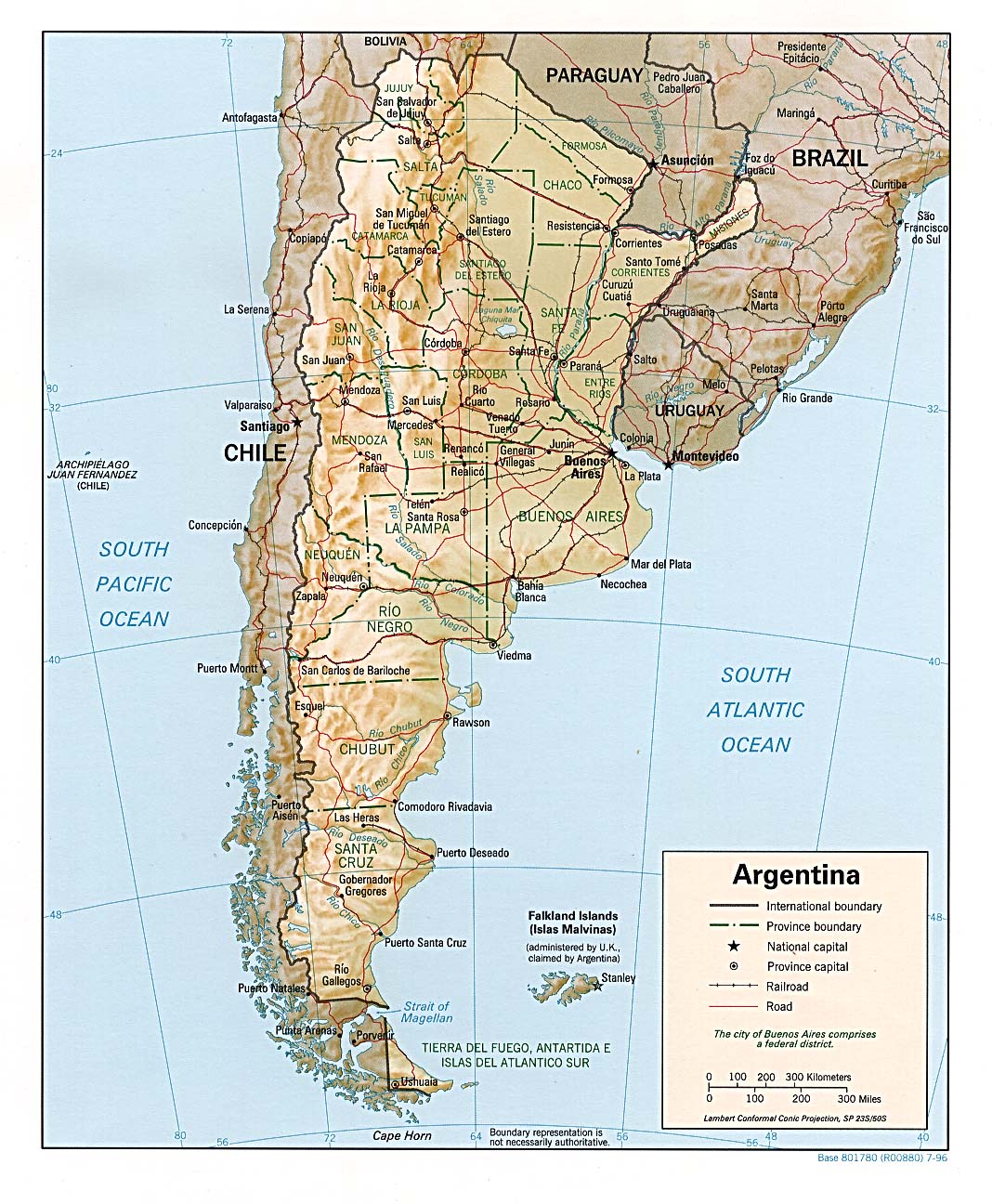
road map of Argenina including railroads and province boundaries.
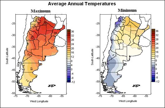
Argentina has a wide range of climates as it lies across multiple latitudes. The grasslands (the Pampas) in the northern half of the country are productive land for agriculture and grazing. Along the western side of Argentina is the Andes mountain range, which divides the country from Chile. Arid and semi-arid land makeup the southeast of Argentina. Patagonia is its most extensive climate, ranging from the southern most tip of Argentina near Antarctica to the central part of the country just east of the mountains. The annual temperatures of these regions are influenced by insolation according to its latitude and elevation. Because Argentina is so large, it's difficult to give the a general average precipitation and temperature, so here is an example of a temperature graph from NOAA of the capital of Buenos Aires. The graph displays the seasonal patterns of the city. Rainfall is concentrated in the NE part of South America because of the Amazon rainforest.
The natural vegetation of Argentina varies upon the region. In the northeast the climate can support a variety of tropical and subtropical species as it stretches up towards Brazil, Paraguay, Bolivia, and Uraguay. Whereas the central northwest vegetation has faced great change over past centuries, due to extensive agriculture and grazing from livestock. However, there are parts that are still relatively preserved, and these are the pampas lowlands. Also home to many species of grasses are the Andean Highlands. The Patagonian Steppe is a sup-polar region that can be described as a shrub land, but has faced desertification in recent years due to grazing by sheep and other large mammals. Deciduous and evergreen trees can be found along the south eastern Andes. The eastern or Wet Chaco is covered by marshlands, ponds, and savannah and is home to a very diverse number of species.
Chaco region

Natural Disasters:
San Miguel de Tucuman and Mendoza areas in the Andes can be earthquakes. The pamperos are dry winds created by the westerlies that can strike the pampas and the northeast.
Argentina experiences volcanic activity in the Andes Mountains along the Chilean border; Copahue (elev. 2,997 m, 9,833 ft) last erupted in 2000; other historically active volcanoes include Llullaillaco, Maipo, Planchon-Peteroa, San Jose, Tromen, Tupungatito, and Vied (CIA).An example of a natural "event" occurred last year when a drought so severely impacted wheat exporting, Argentina faced major consequences.
The capital of Argentina is Buenos Aires, and people from this area refer to themselves as porteños because of the city's location on the rio de la plata.
No comments:
Post a Comment